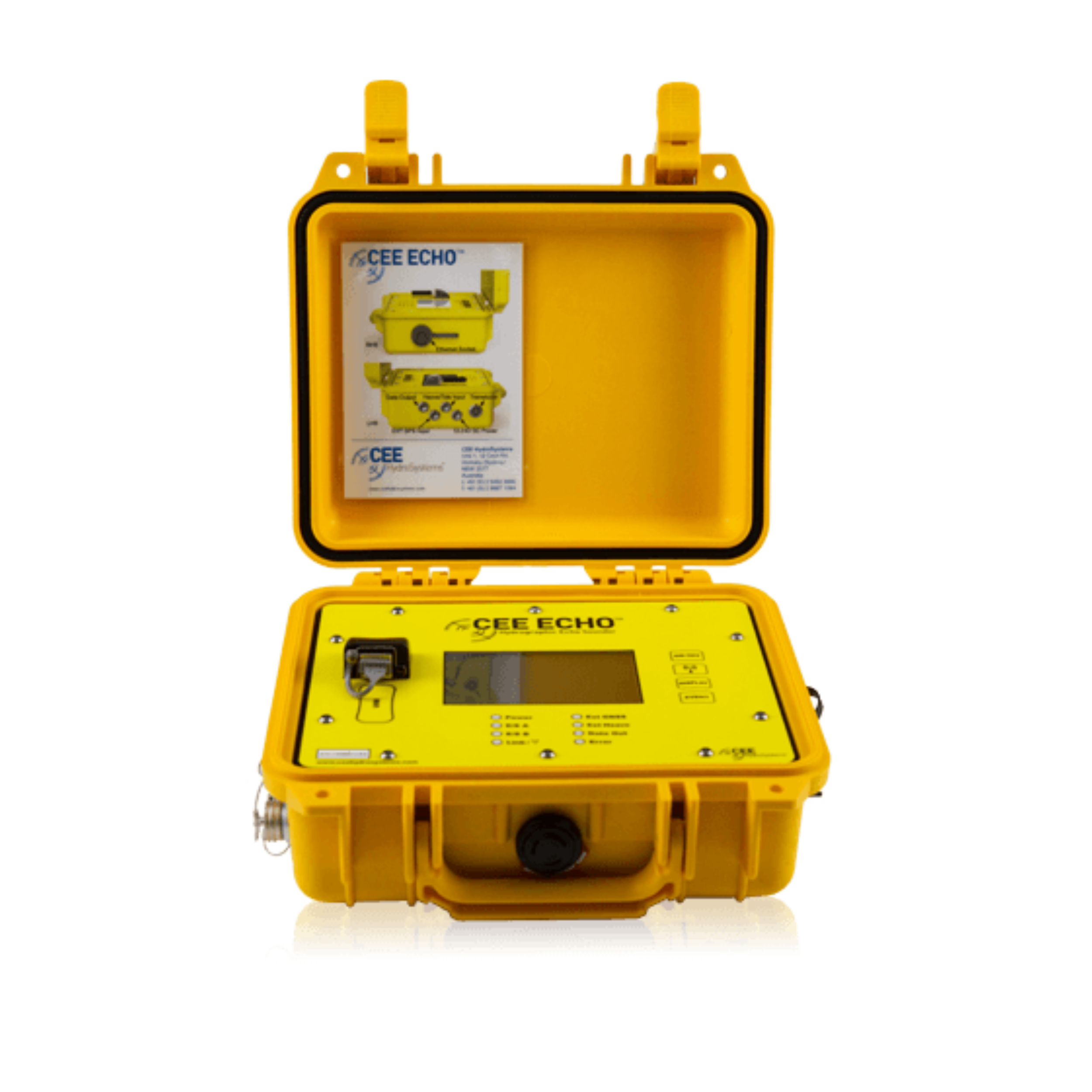
CEE ECHO Single Beam Echo Sounder
Feature
Key Features
-
High-Precision Single Beam Echo Sounding – Accurate depth measurement for bathymetric surveys.
-
Real-Time Data Output – Continuous depth data with stable signal processing.
-
Compact, Lightweight, & Portable – Easy to mount on vessels or small boats.
-
Durable Marine-Grade Construction – Designed for harsh marine conditions.
-
GNSS Integration – Compatible with GPS/GNSS positioning systems.
-
User-Friendly Interface – Simple setup and reliable operation.
-
Flexible Deployment – Ideal for wide variety of survey platforms.
Applications
The CEE ECHO is ideal for:
-
Hydrographic and bathymetric surveys
-
River, reservoir, and lake depth measurements
-
Harbor, coastal, and channel mapping
-
Dredging and underwater inspection
-
Environmental and water resource studies
-
Marine engineering and construction surveys
Why Buy CEE ECHO?
-
Provides accurate and reliable depth measurement in all water conditions.
-
Easy to use and deploy, even in small boats and remote locations.
-
Durable and marine-ready for long-term field use.
-
Ideal for professional marine surveyors, hydrographers, and water resource engineers.
Description
CEE ECHO – Single Beam Echo Sounder for Hydrographic Surveying
The CEE ECHO Single Beam Echo Sounder is a high-performance hydrographic survey instrument designed for accurate depth measurement and underwater mapping. Compact, rugged, and easy to deploy, the CEE ECHO provides real-time depth data for coastal, river, harbor, and inland water surveys. With advanced acoustic technology and seamless GNSS integration, it delivers precise bathymetric results in various survey conditions.
Built for professional marine surveyors and engineers, the CEE ECHO offers reliable performance for hydrography, dredging operations, and waterway inspection. Its user-friendly design, high-accuracy data output, and field-proven durability make it a trusted choice for single beam hydrographic work.
Key Features
-
High-Precision Single Beam Echo Sounding – Accurate depth measurement for bathymetric surveys.
-
Real-Time Data Output – Continuous depth data with stable signal processing.
-
Compact, Lightweight, & Portable – Easy to mount on vessels or small boats.
-
Durable Marine-Grade Construction – Designed for harsh marine conditions.
-
GNSS Integration – Compatible with GPS/GNSS positioning systems.
-
User-Friendly Interface – Simple setup and reliable operation.
-
Flexible Deployment – Ideal for wide variety of survey platforms.
Applications
The CEE ECHO is ideal for:
-
Hydrographic and bathymetric surveys
-
River, reservoir, and lake depth measurements
-
Harbor, coastal, and channel mapping
-
Dredging and underwater inspection
-
Environmental and water resource studies
-
Marine engineering and construction surveys
Why Buy CEE ECHO?
-
Provides accurate and reliable depth measurement in all water conditions.
-
Easy to use and deploy, even in small boats and remote locations.
-
Durable and marine-ready for long-term field use.
-
Ideal for professional marine surveyors, hydrographers, and water resource engineers.
Reviews
There are no reviews yet.