Bathyswath-3 SIGMA B (B3S-B)
Feature
Key Features
-
High-Resolution Multibeam Sonar – Provides detailed seabed mapping and depth data.
-
Accurate Bathymetric Measurement – Reliable results in shallow and deep waters.
-
Real-Time Data Output – Enables efficient survey planning and analysis.
-
Durable & Field-Proven Design – Built for long-term marine operation.
-
User-Friendly Interface – Simplified operation for professional hydrographers.
-
Flexible Deployment – Suitable for vessels, research boats, and survey platforms.
Applications
The Bathyswath-3 SIGMA B (B3S-B) is ideal for:
-
Hydrographic and bathymetric surveys
-
Coastal and offshore engineering projects
-
Dredging and underwater construction monitoring
-
Marine research and environmental studies
-
Harbor, river, and lake seabed mapping
-
Infrastructure inspection and underwater surveying
Why Buy Bathyswath-3 SIGMA B (B3S-B)?
-
Provides precise, high-resolution seabed data for professional surveys.
-
Efficient and reliable operation for demanding marine environments.
-
Rugged and durable design ensures long-term deployment.
-
Ideal for marine surveyors, engineers, and research professionals.
Description
he DS2020 Dual-Channel Navigation Echo Sounder is a high-precision marine instrument designed for accurate depth measurement in both shallow and deep waters. With dual-frequency technology, it ensures reliable and real-time seabed profiling, making it ideal for
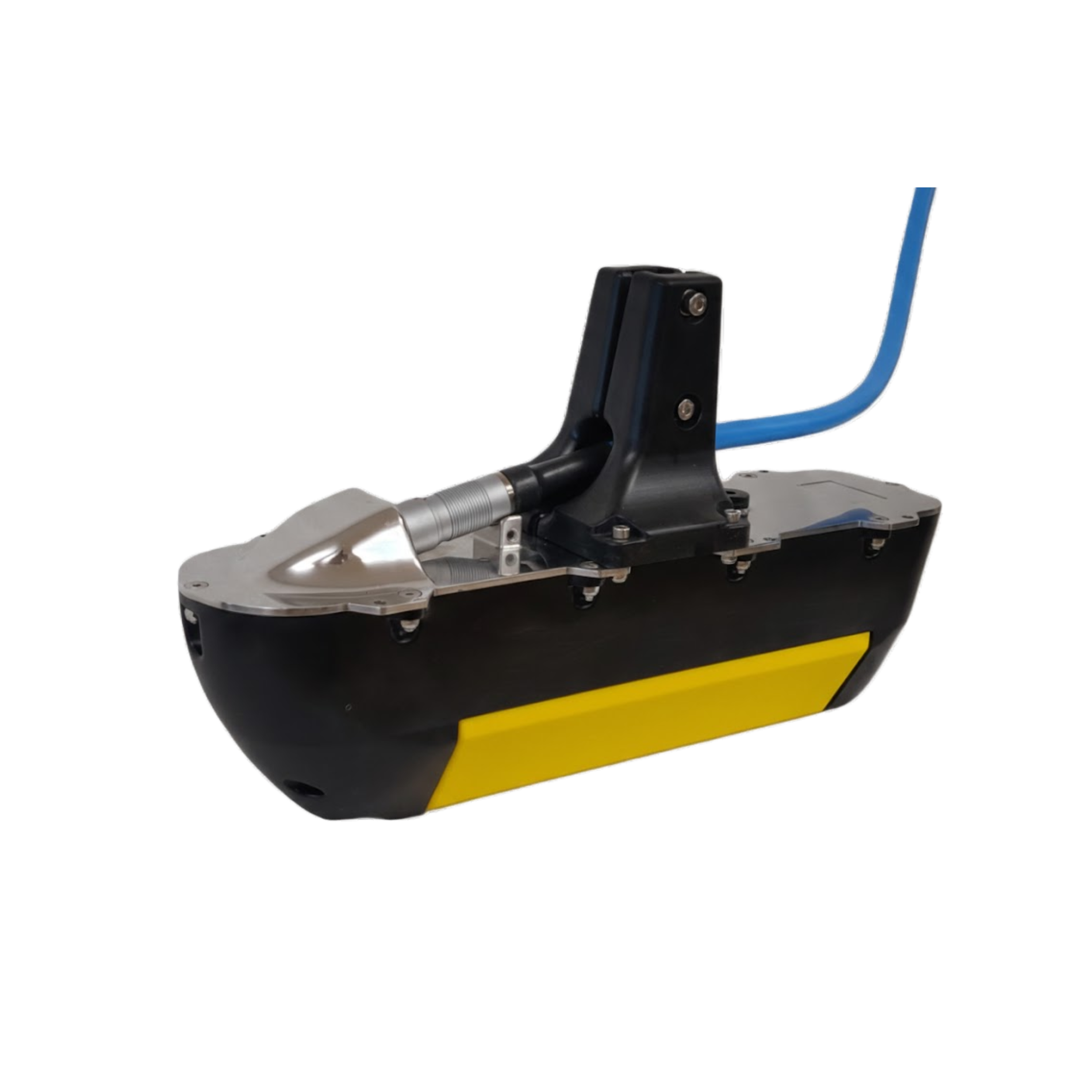
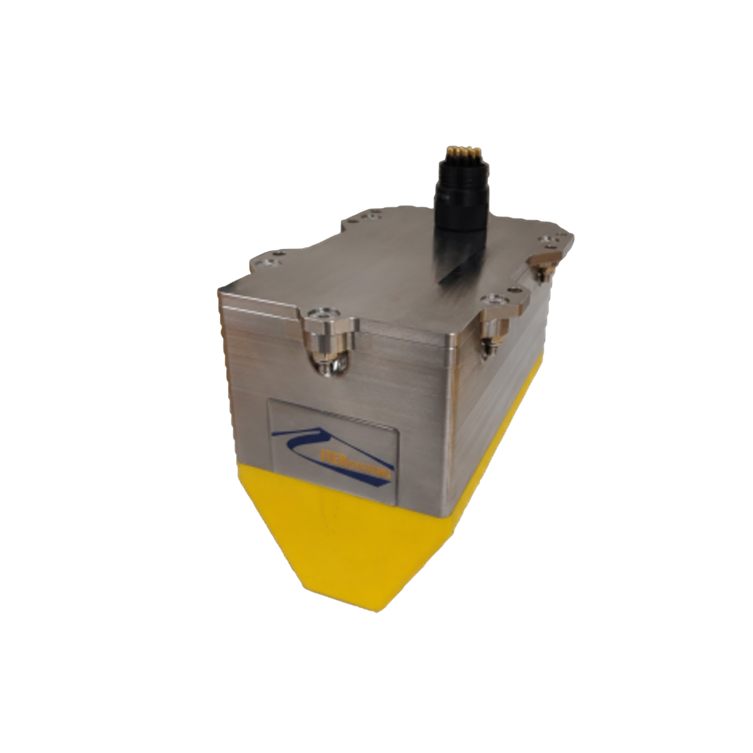
Bathyswath-3 SIGMA B (B3S-B) – Advanced Multibeam Survey System
The Bathyswath-3 SIGMA B (B3S-B) is a high-performance multibeam survey system designed for hydrographic and bathymetric applications. Combining precision sonar technology with advanced signal processing, the B3S-B delivers accurate, high-resolution seabed mapping for marine surveyors, engineers, and researchers. Its robust design and reliable operation make it ideal for offshore, coastal, and inland water projects.
Key Features
-
High-Resolution Multibeam Sonar – Provides detailed seabed mapping and depth data.
-
Accurate Bathymetric Measurement – Reliable results in shallow and deep waters.
-
Real-Time Data Output – Enables efficient survey planning and analysis.
-
Durable & Field-Proven Design – Built for long-term marine operation.
-
User-Friendly Interface – Simplified operation for professional hydrographers.
-
Flexible Deployment – Suitable for vessels, research boats, and survey platforms.
Applications
The Bathyswath-3 SIGMA B (B3S-B) is ideal for:
-
Hydrographic and bathymetric surveys
-
Coastal and offshore engineering projects
-
Dredging and underwater construction monitoring
-
Marine research and environmental studies
-
Harbor, river, and lake seabed mapping
-
Infrastructure inspection and underwater surveying
Why Buy Bathyswath-3 SIGMA B (B3S-B)?
-
Provides precise, high-resolution seabed data for professional surveys.
-
Efficient and reliable operation for demanding marine environments.
-
Rugged and durable design ensures long-term deployment.
-
Ideal for marine surveyors, engineers, and research professionals.
surveys, dredging operations, and marine navigation. Its user-friendly interface, digital display, and data recording capabilities provide efficient performance in all marine environments.
Reviews
There are no reviews yet.