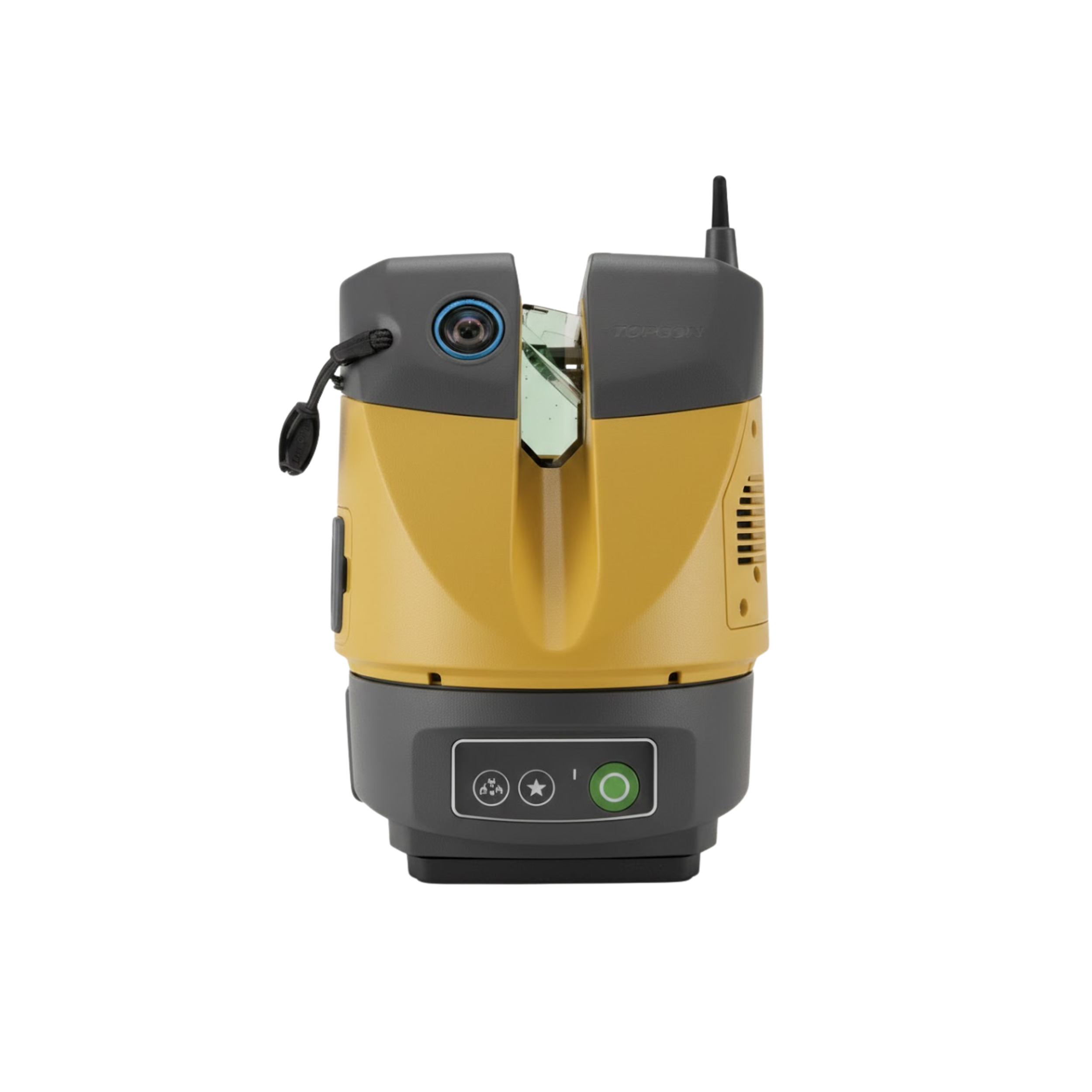
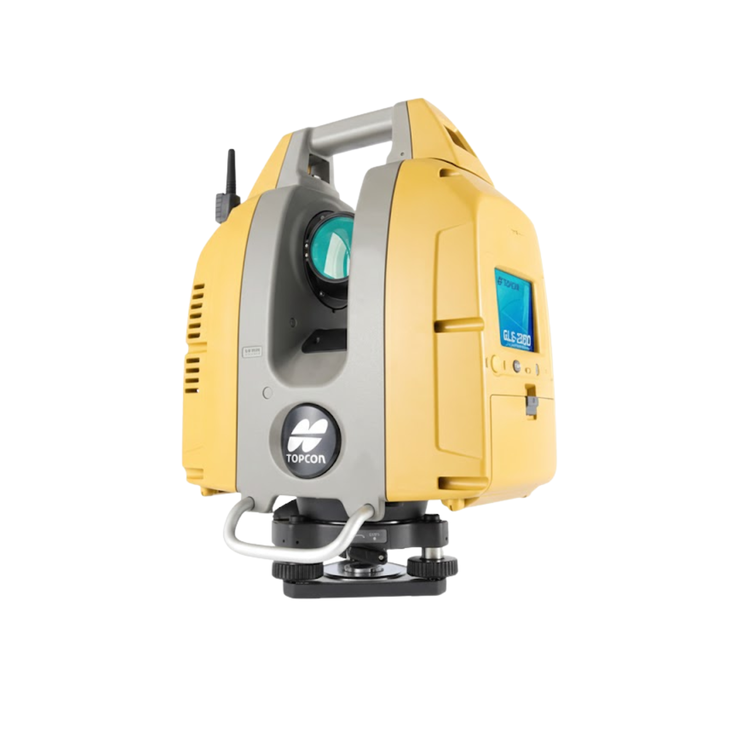
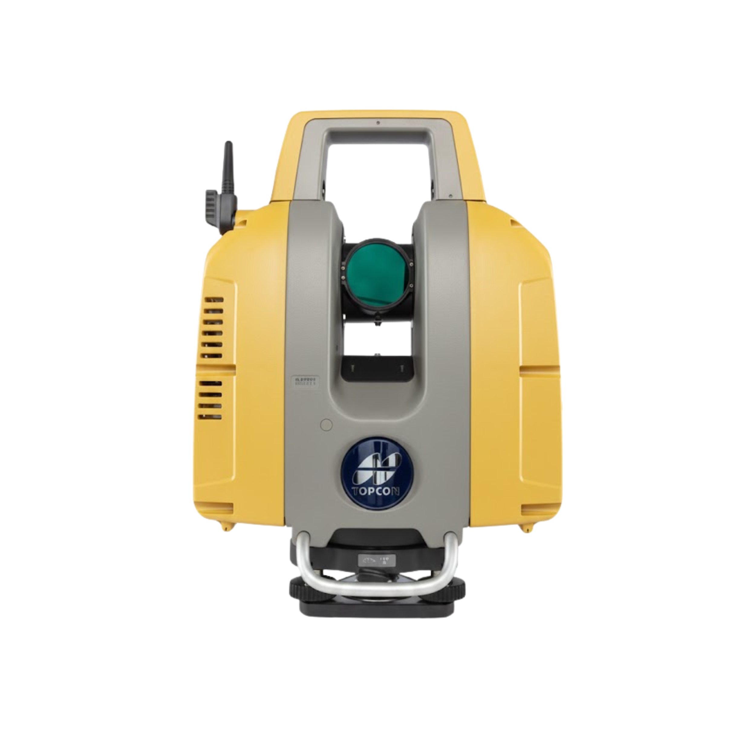
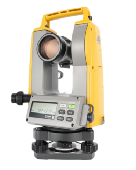
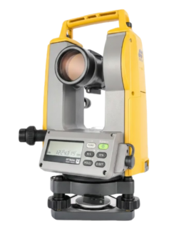
Topcon GLS-2200 3D Laser Scanner
“The Topcon GLS-2200 is a multi-functional terrestrial 3D laser scanner with a range up to 500m. Featuring HDR imagery, 1mm surface accuracy, and a dedicated Road Mode, it is the ultimate reality capture solution for BIM, civil engineering, and structural monitoring in Bangladesh.”
Feature
Key Features
-
High-Speed 3D Scanning for fast, efficient data capture.
-
Long-Range and High Accuracy for detailed results in large-scale projects.
-
High-Density Point Clouds for precision modeling and inspection.
-
Rugged and Field-Ready Design built for tough outdoor conditions.
-
User-Friendly Interface for fast setup and easy operation.
-
Seamless Data Integration for BIM, CAD, GIS, and engineering software.
Applications
The GLS-2200 is ideal for:
-
Construction site measurement
-
As-built documentation
-
BIM and digital twin workflows
-
Structural and deformation monitoring
-
Roads, bridges, tunnels, and industrial projects
-
Topographic and architectural surveying
Why Buy GLS-2200?
-
Ensures high-accuracy 3D scanning and detailed data capture.
-
Saves time and cost with fast scanning and simple workflow.
-
Durable and reliable for long-term outdoor and professional use.
-
Perfect for surveyors, engineers, and construction professionals who need precise 3D results.
Brochure
Description
3D Laser Scanner Price: Topcon GLS-2200 Complete Guide
The construction industry in Bangladesh is undergoing a digital revolution. With the adoption of Building Information Modeling (BIM) and advanced civil engineering workflows, traditional survey methods are often too slow. This is where the Topcon GLS-2200 3D Laser Scanner comes in. If you are researching the 3D Laser Scanner price for your firm, the GLS-2200 represents a high-value investment that offers “Japanese Quality” and unmatched field versatility.
Why the Topcon GLS-2200 is a Market Leader
The GLS-2200 is a terrestrial laser scanner designed to handle everything from short-range facility mapping to long-range topographic surveys. It is particularly famous for its unique surveyor-style setup, which allows the scanner to be georeferenced in the field using resection or backsight—saving hours of data registration in the office.
Key Technical Specifications
-
Scan Range Options: Three models available: S (130m), M (350m), and L (500m).
-
Speed: Captures up to 120,000 points per second.
-
Surface Accuracy: Delivers a crystal-clear 1mm plane fit accuracy for high-precision verification.
-
HDR Imaging: Dual 5MP cameras capture High Dynamic Range images to create realistic, colorized 3D point clouds.
-
Specialized Modes: Features a dedicated “Road Mode” for scanning dark asphalt and “Close Mode” for tight industrial spaces.
Estimated 3D Laser Scanner price in Bangladesh (2026)
High-end terrestrial scanners like the GLS-2200 are premium industrial instruments. While the 3D Laser Scanner price can vary based on currency exchange and duty rates, here is an estimated market range for the Bangladesh market in 2026:
| Model Version | Scan Range | Estimated Price (BDT) |
| GLS-2200 S | 130 Meters | 75,00,000 – 85,00,000 ৳ |
| GLS-2200 M | 350 Meters | 90,00,000 – 1,10,00,000 ৳ |
| GLS-2200 L | 500 Meters | 1,20,00,000 – 1,50,00,000 ৳ |
Note: These estimates usually include the scanner, power kit (8 batteries), transport case, and processing software like MAGNET Collage. For used or refurbished units, prices can range significantly lower, often between $15,000 and $30,000 USD (approx. 18-35 Lakh BDT) depending on condition.
Top Features for Maximum ROI
1. Eight Measurement Modes
The GLS-2200 is a “one-size-fits-all” solution. You can switch between High Speed, Standard, Low Power, and specialized modes like Asphalt Road. This ensures you get the right point density for every job site, whether it’s a bridge inspection or a small building interior.
2. 200m Target Scanning Range
While the scan distance can reach 500m, the ability to accurately scan targets (resection) from 200m away is a game-changer. This reduces the number of instrument setups required on large sites, cutting field time by up to 30%.
3. Seamless BIM Integration
The data captured by the GLS-2200 is fully compatible with Autodesk Revit, Navisworks, and ClearEdge3D Verity. This allows for “As-Built vs. Design” verification, ensuring that construction is proceeding according to the digital model.
Common Applications in Bangladesh
-
Bridge & Piling Projects: Monitoring deformation and checking structural integrity.
-
Road & Highway (ICT Paving): Using Road Mode for QA/QC of new asphalt surfaces.
-
Industrial Facilities: Creating digital twins of factories for pipe installation and maintenance.
-
Heritage Preservation: Digitizing ancient sites like the Shat Gombuj Mosque for future restoration.
Conclusion
When evaluating the 3D Laser Scanner price, you must consider the total cost of ownership. The Topcon GLS-2200 offers durability, rapid field registration, and the backing of a global support network. For firms aiming to lead in the digital construction era, this scanner is the most reliable tool in the market.
Why Buy GLS-2200?
- Ensures high-accuracy 3D scanning and detailed data capture.
- Saves time and cost with fast scanning and simple workflow.
- Durable and reliable for long-term outdoor and professional use.
- Perfect for surveyors, engineers, and construction professionals who need precise 3D results.
Reviews
There are no reviews yet.