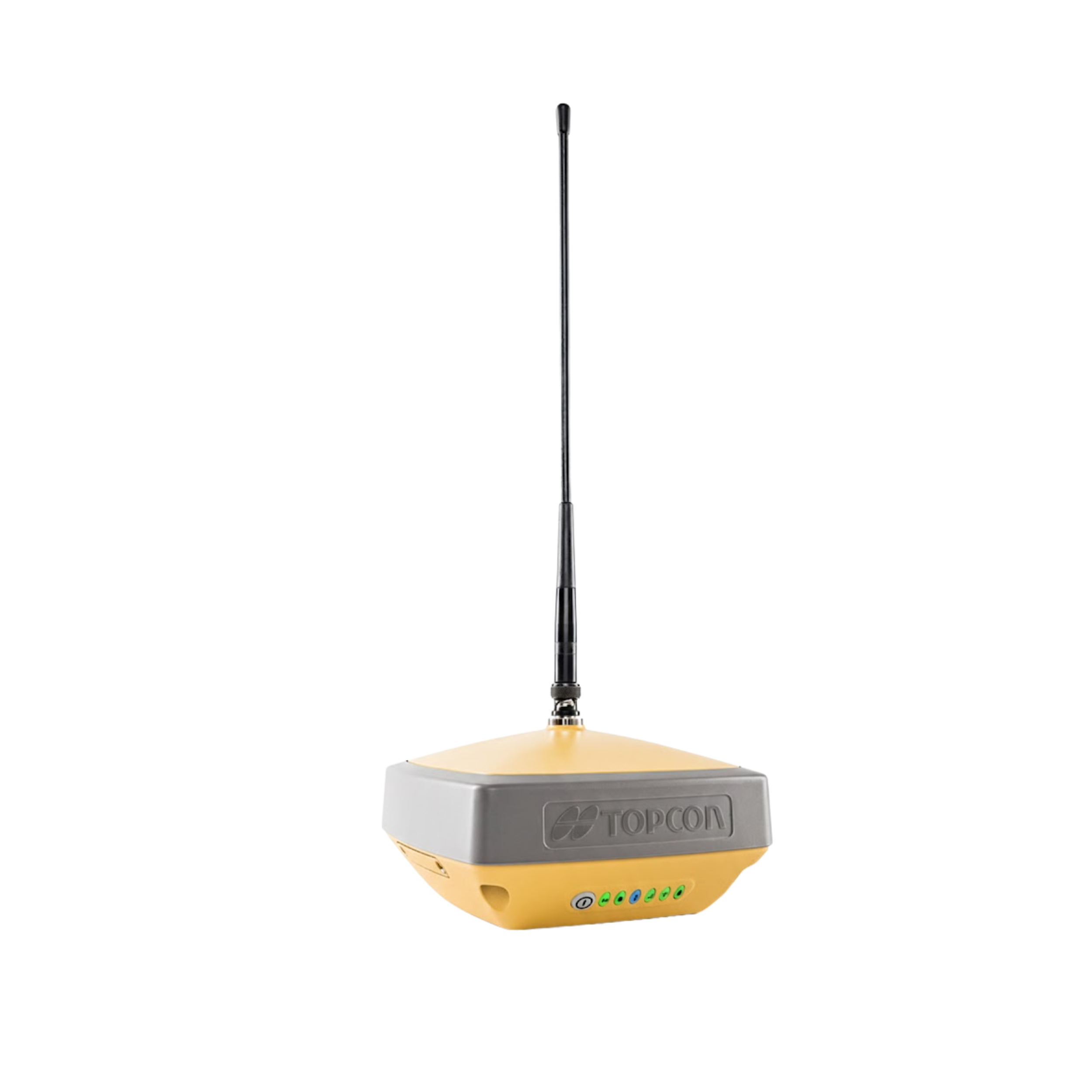
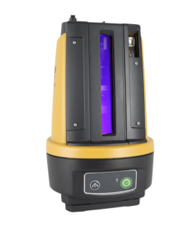
Topcon HiPer CR GNSS Receiver
The HiPer CR is an ultra-compact, lightweight GNSS receiver designed for high-precision accuracy without the bulk. Featuring 226-channel Universal Tracking Technology, it supports all major satellite constellations (GPS, GLONASS, Galileo, BeiDou). Weighing only 440g, this IP67-rated powerhouse offers 10 hours of battery life and LongLink™ Bluetooth connectivity, making it the ultimate tool for surveyors seeking the best RTK GNSS price and performance balance.
Feature
Key Features
-
High-Precision GNSS Performance – Delivers accurate positioning for surveying and construction projects.
-
Multi-Constellation Support – Works with GPS, GLONASS, Galileo, and BeiDou for maximum reliability.
-
Durable & Rugged Design – Built to perform in tough weather and harsh field conditions.
-
Lightweight & Compact – Easy to carry, deploy, and operate onsite.
-
Long Battery Operation – Ensures uninterrupted fieldwork.
-
Real-Time Data Output – Integrates smoothly with data collectors and GIS systems.
-
Supports Multiple Surveying Modes – Perfect for RTK, static, and post-processing work.
Applications
The HiPer CR GNSS Receiver is ideal for:
-
Land surveying and topographic mapping
-
Construction site layout and monitoring
-
Infrastructure and civil engineering projects
-
Road and bridge alignment
-
GIS data collection and asset mapping
-
Precision positioning for RTK and static surveys
Why Buy HiPer CR?
-
Provides fast, precise, and reliable GNSS positioning in any condition.
-
Saves time and boosts productivity with multi-satellite support.
-
Rugged for long-term outdoor use and heavy-duty job sites.
-
Lightweight and practical for surveyors, engineers, and GIS professionals.
Brochure
Description
Topcon HiPer CR GNSS Receiver: High Precision Performance and RTK GNSS Price in Bangladesh
In the rapidly evolving landscape of surveying and civil engineering in Bangladesh, precision is no longer a luxury—it is a necessity. The Topcon HiPer CR GNSS Receiver has emerged as a game-changer for professionals seeking a compact, lightweight, and powerful solution. If you are researching the best RTK GNSS Price in Bangladesh, this guide provides a comprehensive look at the features, benefits, and market value of this Japanese-engineered masterpiece.
Why Choose the Topcon HiPer CR?
The Topcon HiPer CR is designed for versatility. Whether you are working on a massive infrastructure project like a highway or performing a precise land boundary survey, this receiver delivers “fixed” solutions where others struggle.
1. Ultra-Compact and Lightweight Design
One of the most significant advantages of the HiPer CR is its size. Weighing only 440 grams, it is one of the lightest GNSS receivers in the world. For surveyors working 8 to 10 hours in the field under the Bangladeshi sun, this reduction in weight significantly decreases fatigue and increases productivity.
2. Multi-Constellation Tracking
The HiPer CR isn’t just a GPS; it is a full-spectrum GNSS receiver. It tracks signals from:
-
GPS, GLONASS, Galileo, BeiDou, QZSS, and SBAS.
With more satellites in view, the receiver maintains a “Fixed” status even in challenging environments like narrow urban alleys in Dhaka or under heavy tree canopies in rural areas.
3. Long-Range Bluetooth® (LongLink™)
Unlike traditional receivers that rely heavily on bulky external radios, the HiPer CR features LongLink™ technology. This allows a Base and Rover setup to communicate via Bluetooth over distances of up to 300 meters, making it perfect for small to medium-sized construction sites without the need for a frequency license.
Technical Specifications at a Glance
| Feature | Specification |
| Channels | 226 Universal Tracking Channels |
| Dust/Water Protection | IP67 (Submersible up to 1 meter) |
| Operating Time | Up to 10 Hours |
| Shock Resistance | 2-meter pole drop to concrete |
| Communication | Bluetooth, LongLink, and Integrated Cellular |
Analyzing the RTK GNSS Price in Bangladesh (2026 Update)
Understanding the RTK GNSS Price in Bangladesh is crucial for budgeting your engineering projects. The price typically varies based on currency fluctuations, import duties, and the specific bundle (controller, tripod, and software) you choose.
Currently, the price range for the Topcon HiPer CR is approximately:
-
Single Rover Setup: BDT 4,50,000 – 5,50,000
-
Full Base & Rover Kit: BDT 9,00,000 – 11,50,000
-
Network RTK (Internal SIM) Configuration: BDT 5,00,000+
Note: For the most accurate and up-to-date quote, it is recommended to contact an authorized Topcon distributor to ensure you receive a genuine product with a valid warranty.
Benefits for the Bangladeshi Surveying Sector
Durable for Local Conditions
The IP67 rating ensures that the device can survive the heavy monsoon rains and dusty construction environments common in Bangladesh. Its rugged housing is built to withstand the rigors of the field.
Hybrid Positioning Ready
The HiPer CR can be integrated into a Topcon Hybrid Positioning workflow. This means you can use it alongside a Robotic Total Station. If the GNSS signal is lost near a building, the system automatically switches to the Total Station, ensuring your work never stops.
Seamless Software Integration
By using MAGNET Field software, surveyors can easily collect data and sync it with the office in real-time. This eliminates the risk of data loss and speeds up the mapping process.
Conclusion
The Topcon HiPer CR represents the perfect balance between portability and power. While looking for the best RTK GNSS Price in Bangladesh, it is important to consider the “Total Cost of Ownership”—the HiPer CR’s durability and Japanese reliability mean fewer repairs and a longer lifespan compared to cheaper alternatives.
Investing in Topcon technology ensures that your surveying firm stays ahead of the competition by delivering high-precision results every time.
Reviews
There are no reviews yet.