Phone: +88 017 06611166 Email: info@surveyinstrumentbd.com
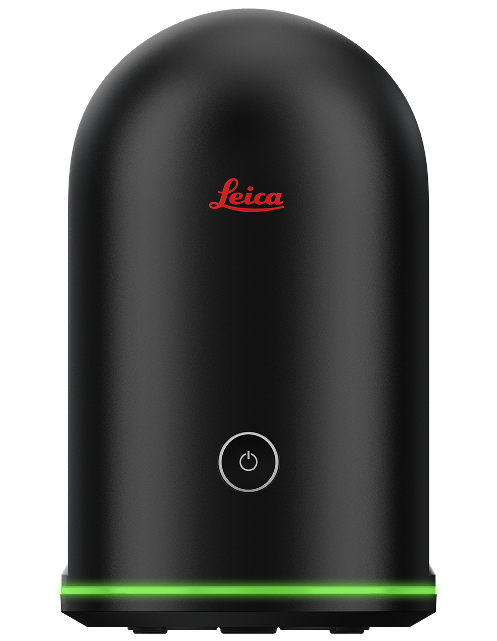
LEICA 3D SCANNER BLK360
Features
The Leica BLK360 captures the world around you with full-colour panoramic images overlaid on a high-accuracy point cloud. Simple to use with the single push of one button, the BLK360 is the smallest and lightest imaging laser scanner of its kind. Anyone who can operate an iPad can now capture the world around them with high resolution 3D panoramic images.
Using Leica Cyclone FIELD 360 mobile-device app, the BLK360 streams image and point cloud data to an iPad or final project data to Cyclone REGISTER 360 or Cyclone REGISTER 360 (BLK Edition) via Wi-Fi. With automated workflows in both software offerings, the BLK360 plus the software solution of your choice, dramatically streamlines the reality capture process thereby opening this technology to non-surveying individuals. Simple export of LGS or RCP files makes working with point cloud data downstream in the Leica Geosystems and Autodesk suites simple and efficient, allowing users to spend less time processing data and more time creating meaningful deliverables.
SKU: 3D Scanner
Category: 3D Scanner, Leica 3D Scanner
Product Details
| GENERAL | |
| Imaging scanner | 3D scanner with integrated spherical imaging system and thermography panorama sensor system |
| DESIGN & PHYSICAL | |
| Housing | Black anodized aluminium |
| Dimensions | Height: 165 mm / Diameter: 100 mm |
| Weight | 1kg |
| Transport cover | Hood with integrated floorstand |
| Mounting mechanism | Button-press quick release |
| OPERATION | |
| Stand-alone operation | One-button operation |
| Remote operation | iPad app, Apple iPad Pro® 12.9”/iOS 10 or later |
| Wireless communication | Integrated wireless LAN (802.11 b/g/n) |
| Internal memory | Storage for > 100 setups |
| Instrument orientation | Upright and upside down |
| POWER | |
| Battery type | Internal, rechargeable Li-Ion battery (Leica GEB212) |
| Capacity | Typically >40 setups |
| SCANNING | |
| Distance measurement system | High speed time of flight enhanced by Waveform Digitizing (WFD) technology |
| Laser class | 1 (in accordance with IEC 60825-1:2014) |
| Wavelength | 830 nm |
| Field of view | 360° (horizontal) / 300° (vertical) |
| Range* | min. 0.6 - up to 60 m |
| Point measurement rate | up to 360’000 pts / sec |
| Ranging accuracy* | 4mm @ 10m / 7mm @ 20m |
| Measurement modes | 3 user selectable resolution settings |
| IMAGING | |
| Camera System | 15 Mpixel 3-camera system, 150Mpx full dome capture, HDR, LED flash Calibrated spherical image, 360° x 300° |
| Thermal Camera | FLIR technology based longwave infrared camera, Thermal panoramic image, 360° x 70° |
| PERFORMANCE | |
| Measurement speed | < 3 min for complete fulldome scan, spherical image & thermal image |
| 3D point accuracy* | 6mm @ 10m / 8mm @ 20m |
| ENVIRONMENTAL | |
| Robustness | Designed for indoor and outdoor use |
| Operating temperature | +5 to +40° C |
| Dust/Humidity | Solid particle/liquid ingress protection IP54 (IEC 60529) |
More Information
DATA ACQUISITION
Live image and scanned data streaming
Live data viewing and editing
Automatic tilt measurements