Phone: +88 017 06611166 Email: info@surveyinstrumentbd.com
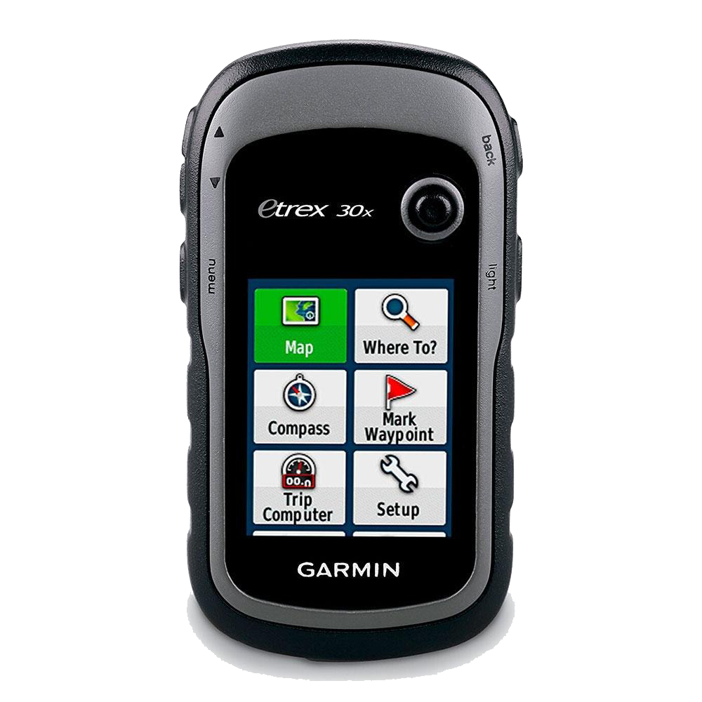
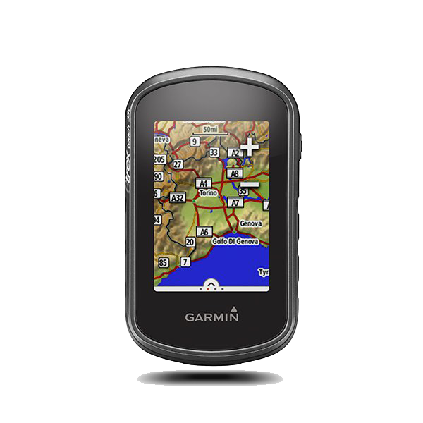
GARMIN HANDHELD GPS ETREX 30x
Features
Handheld GPS, 3-axis Compass: Better Resolution and Memory
- Greater resolution with 240 x 320 display pixels for improved readability
- Internal memory expanded to hold more maps
- Worldwide basemap with shaded relief
- 2.2-inch, 65K color, sunlight-readable display
- 3-axis compass and barometric altimeter
eTrex 30x is our upgraded version of the popular eTrex 30, with enhanced screen resolution for a more readable display and internal memory expanded to hold more maps. It retains the ease-of-use, durability and affordability that eTrex is legendary for and can also be used on ATVs, bicycles, boats, cars or hot air balloons.
See the Way
eTrex 30x has an enhanced 2.2-inch, 65K color, sunlight-readable display. Durable and water resistant, eTrex 30x is built to withstand the elements. It has an upgraded interface yet retains its legendary toughness to withstand dust, dirt, humidity or water.
New Tools for Your Trek
eTrex 30x adds a built-in 3-axis tilt-compensated electronic compass, which shows your heading even when you’re standing still, without holding it level. Also added is a barometric altimeter which tracks changes in pressure to pinpoint your precise altitude, and you even can use it to plot barometric pressure over time, which can help you keep an eye on changing weather conditions
SKU: GPS
Category: Global Positioning System (GPS), Garmin Handheld GPS
Product Details
General
| PHYSICAL DIMENSIONS | 2.1" x 4.0" x 1.3" (5.4 x 10.3 x 3.3 cm) |
| DISPLAY SIZE | 1.4" x 1.7" (3.5 x 4.4 cm); 2.2" diag (5.6 cm) |
| DISPLAY RESOLUTION | 240 x 320 pixels |
| DISPLAY TYPE | 2.2" transflective, 65K color TFT |
| WEIGHT | 5 oz (141.7 g) with batteries |
| BATTERY TYPE | 2 AA batteries (not included); NiMH or Lithium recommended |
| BATTERY LIFE | 25 hours |
| WATER RATING | IPX7 |
| HIGH-SENSITIVITY RECEIVER | Yes |
| INTERFACE | mini USB |
| MEMORY/HISTORY | 3.7 GB |
Maps & Memory
| ABILITY TO ADD MAPS | Yes |
| BASEMAP | Yes |
| AUTOMATIC ROUTING (TURN BY TURN ROUTING ON ROADS) FOR OUTDOOR ACTIVITIES | Yes (with optional mapping for detailed roads) |
| MAP SEGMENTS | 3000 |
| BIRDSEYE | 250 BirdsEye Imagery files |
| INCLUDES DETAILED HYDROGRAPHIC FEATURES (COASTLINES, LAKE/RIVER SHORELINES, WETLANDS AND PERENNIAL AND SEASONAL STREAMS) | no (additional mapping needed) |
| INCLUDES SEARCHABLE POINTS OF INTERESTS (PARKS, CAMPGROUNDS, SCENIC LOOKOUTS AND PICNIC SITES) | no (additional mapping needed) |
| DISPLAYS NATIONAL, STATE AND LOCAL PARKS, FORESTS, AND WILDERNESS AREAS | no (additional mapping needed) |
| EXTERNAL MEMORY STORAGE | yes (32 GB max microSD™ card) |
| WAYPOINTS/FAVORITES/LOCATIONS | 2000 |
| TRACKS | 200 |
| TRACK LOG | 10,000 points, 200 saved tracks |
| ROUTES | 200, 250 points per route; 50 points auto routing |
Sensors
| GPS | Yes |
| GLONASS | Yes |
| BAROMETRIC ALTIMETER | Yes |
| COMPASS | Yes (tilt-compensated 3-axis) |
| GPS COMPASS (WHILE MOVING) | Yes |
Daily Smart Features
| VIRB® REMOTE | Yes |
Outdoor Recreation
| POINT-TO-POINT NAVIGATION | Yes |
| COMPATIBLE WITH BASECAMP™ | Yes |
| AREA CALCULATION | Yes |
| HUNT/FISH CALENDAR | Yes |
| SUN AND MOON INFORMATION | Yes |
| GEOCACHING-FRIENDLY | Yes (Paperless) |
| CUSTOM MAPS COMPATIBLE | Yes (100 custom map tiles) |
| PICTURE VIEWER | Yes |
Connections
| WIRELESS CONNECTIVITY | Yes (ANT+®) |
More Information