Phone: +88 017 06611166 Email: info@surveyinstrumentbd.com
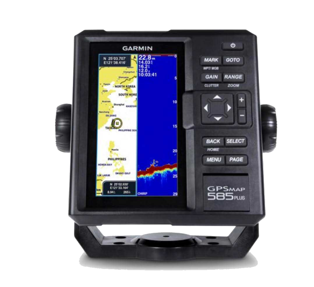
GARMIN FISH FINDER GPSMAP 585 PLUS
Features
Find fishing spot, Catch fish with the Power of Garmin CHIRP
- Multi language support : English, Simplified Chinese, Traditional Chinese, Japanese, Korean, Indonesia Bahasa, Malaysia Bahasa, Vietnamese, Burmese, Thai.
- Available in 6-inch WVGA color, portrait mode display. Offers a keyed interface with dedicated buttons.
- CHIRP sonar sends a continuous sweep of frequencies ranging from low to high. CHIRP sonar is able to create crisper fish arches with better target separation.
- Built-in 600 W (RMS) CHIRP traditional sonar and CHIRP ClearVü scanning sonar gives a clearer picture of what’s below the boat as a photographic image with representation of objects, structure and fish.
- Compatible with GPS, GLONASS and BeiDou powerful positioning systems what quick and easy to drop up to 12,000 accurate waypoints let you find your way back to your secret fishing hot spots.
- Free, easy-to-use Quickdraw Contours software instantly creates personalized HD fishing maps is included.
- GPSMAP 585 Plus supports for typical NMEA0183 and RS422 communication within 3rd party sensors and accessories.
- 2 standard SD™ card slots provides expandable memory for accessory map purchases such as LakeVü HD Ultra maps and BlueChart® g2 Vision® charts.
The all-new GPSMAP 585 Plus chart plotter / sonar combo is available in 6-inch display. GPSMAP 585 Plus is offered a worldwide basemap and support all Garmin marine charts also with Asian multi language support and developed the target for semi-commercial fishing market. GPSMAP 585 Plus gives you high wide CHIRP sonar and CHIRP ClearVü scanning sonar capabilities which shows crisp fish arches with excellent target separation and provides clear images of structure below the boat. Supporting GPS, GPS + GLONASS, GPS + BEIDOU 3 kind of positioning modes. New Garmin Quickdraw™ Contours software included lets you create your own maps, with up to 1-foot contour lines, on any body of water.
The Power of Garmin CHIRP
The built-in sonar capabilities of GPSMAP 585 Plus includes CHIRP sonar, the most sophisticated sonar technology available for the fishing and boating public. CHIRP sonar provides amazingly clear target separation and definition because it puts even more energy onto the target than traditional sonar. It also includes sonar-recording capability that coordinates the timing of the sonar return with your boat's position and saves digital information for playback on a computer using HomePort™ planning software. Use the user data sharing cable to share waypoints and routes between multiple devices.
SKU: Fish Finder
Category: Global Positioning System (GPS), Garmin Fish Finder
Product Details
PHYSICAL & PERFORMANCE
| PHYSICAL DIMENSIONS | 176.0 mm x 190.0 mm x 66.0 mm (6.93” x 7.48” x 2.60”) |
| DISPLAY SIZE, WXH | 2.83" x 5.36"; 6.0" diagonal (72.0 mm x 136.2 mm; 152.4 mm diagonal) |
| DISPLAY RESOLUTION, WXH | 480 x 800 pixels |
| DISPLAY TYPE | WVGA display |
| WEIGHT | 816.0 g (1.80 lbs) |
| WATER RATING | IPX7 |
| GPS RECEIVER | GPS/GLONASS/BeiDou, internal |
| NMEA 0183/RS422 COMPATIBLE | Yes |
| POWER CONSUMPTION | 7.6 W |
| VOLTAGE RANGE | 10V - 36V DC input |
| MOUNTING OPTIONS | Bail or flush |
MAPS & MEMORY
| PRELOADED MAPS | GPSMAP 585 Plus, APAC (worldwide basemap) GPSMAP 585 Plus, w/g2, SEA (built-in SEA g2 chart) |
| ACCEPTS DATA CARDS | 2 standard SD |
| WAYPOINTS | 12,000 |
| ROUTES | 200 |
| TRACK LOG | one 50,000 points active track; 100 saved tracks |
CHARTPLOTTER FEATURES
| GARMIN SONAR COMPATIBLE | Yes |
| SUPPORTS AIS (TRACKS TARGET SHIPS POSITION) | Yes |
| SUPPORTS DSC (DISPLAYS POSITION DATA FROM DSC-CAPABLE VHF RADIO) | Yes |
| TIDE TABLES | Yes |
SONAR FEATURES & SPECIFICATIONS
| TRANSMIT POWER | 600W (RMS) |
| SONAR FREQUENCY | 50/77/200kHz CHIRP (Low, Mid, High) |
| CLEARVÜ™ | (built-in) |
| SCANNING SONAR FREQUENCY | CHIRP 260/455/800kHz |
| MAXIMUM DEPTH | 2,300 ft, freshwater, 1,100 ft, saltwater (depth capacity is dependent on water bottom type and other water conditions) |
| BOTTOM LOCK (SHOWS RETURN FROM THE BOTTOM UP) | Yes |
| WATER TEMPERATURE LOG AND GRAPH | Yes |
| SPLIT-SCREEN ZOOM | Yes |
| FISH SYMBOL ID (HELPS IDENTIFY FISH TARGETS) | Yes |
| SONAR RECORDING | Yes |
| SONAR HISTORY REWIND | Yes |
CONNECTIONS
| TRANSDUCER CONNECTOR PIN NUMBERS | 8 |
| 8-PIN POWER/NMEA 0183 CONNECTOR | 1 |
| BNC FOR EXTERNAL GPS ANTENNA | 1 |
More Information