Phone: +88 017 06611166 Email: info@surveyinstrumentbd.com
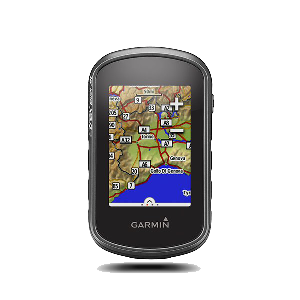
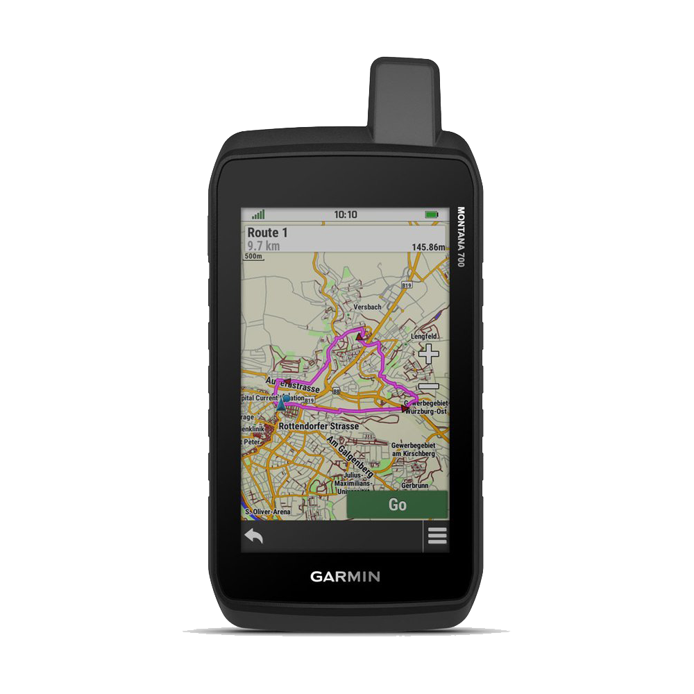
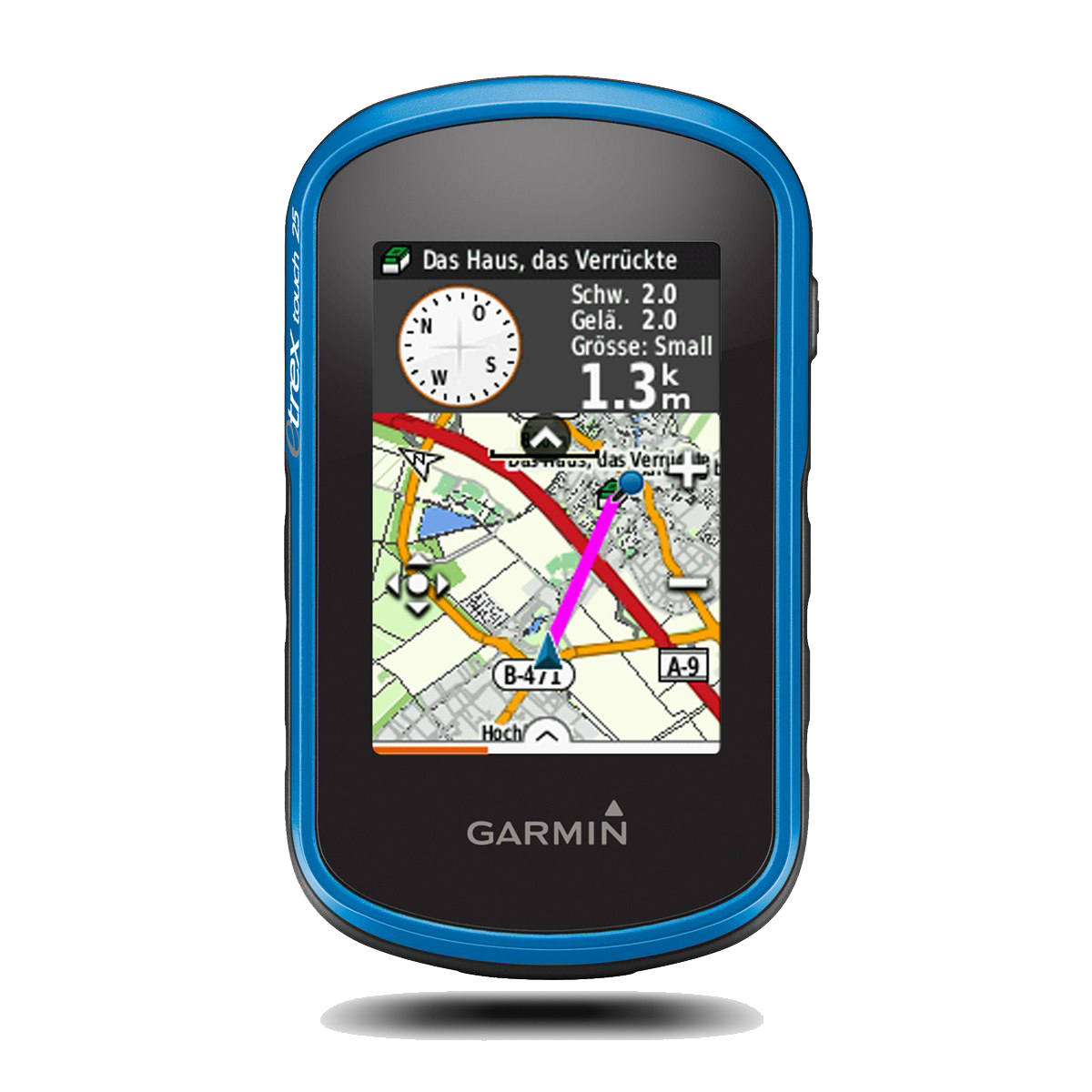
GARMIN HANDHELD GPS ETREX 35x
Features
Color Touchscreen GPS/GLONASS Handheld with 3-axis Compass, Barometric Altimeter
- 2.6-inch color capacitive touchscreen
- 3-axis tilt-compensated compass and barometric altimeter
- GPS and GLONASS satellites for faster positioning
- 250,000 preloaded geocaches from Geocaching.com
- 4 GB memory to hold more maps
Compact, rugged and reliable GPS/GLONASS handheld with color touchscreen, featuring a barometric altimeter and 3-axis tilt-compensated electronic compass, wireless connectivity, preloaded geocaches and expanded internal memory to hold more maps.
See the Way
eTrex Touch 35 features a sunlight-readable, 2.6-inch color touchscreen display offering intuitive access to worldwide basemap with shaded relief. Durable and water resistant, eTrex Touch 35 is built to keep delivering vital mapping and tracking data no matter what the elements throw at you, standing strong against dust, dirt, humidity and water.
Go Global
eTrex Touch 35 can track both GPS and GLONASS satellites simultaneously. Developed by the Russian Federation, GLONASS satellites “lock on” to a position (on average) approximately 20 percent faster than GPS receivers. Using both GPS and GLONASS means the receiver has the ability to lock on to 24 more satellites than using GPS alone.
SKU: GPS
Category: Global Positioning System (GPS), Garmin Handheld GPS
Product Details
General
| PHYSICAL DIMENSIONS | 2.3” x 4.0” x 1.3” (5.8 x 10.2 x 3.3 cm) |
| Touchscreen | Yes |
| DISPLAY SIZE | 1.43" x 2.15" (3.6 x 5.5 cm) |
| DISPLAY RESOLUTION | 160 x 240 pixels |
| DISPLAY TYPE | 2.6" 65K color TFT |
| WEIGHT | 5.6 oz (159 g) with batteries |
| BATTERY TYPE | 2 AA batteries (not included); NiMH or Lithium recommended |
| BATTERY LIFE | 16 hours |
| WATER RATING | IPX7 |
| HIGH-SENSITIVITY RECEIVER | Yes |
| INTERFACE | mini USB |
| MEMORY/HISTORY | 4 GB |
Maps & Memory
| ABILITY TO ADD MAPS | Yes |
| BASEMAP | Yes |
| AUTOMATIC ROUTING (TURN BY TURN ROUTING ON ROADS) FOR OUTDOOR ACTIVITIES | Yes (with optional mapping for detailed roads) |
| MAP SEGMENTS | 4000 |
| BIRDSEYE | 250 BirdsEye Imagery files |
| INCLUDES DETAILED HYDROGRAPHIC FEATURES (COASTLINES, LAKE/RIVER SHORELINES, WETLANDS AND PERENNIAL AND SEASONAL STREAMS) | no (additional mapping needed) |
| INCLUDES SEARCHABLE POINTS OF INTERESTS (PARKS, CAMPGROUNDS, SCENIC LOOKOUTS AND PICNIC SITES) | no (additional mapping needed) |
| DISPLAYS NATIONAL, STATE AND LOCAL PARKS, FORESTS, AND WILDERNESS AREAS | no (additional mapping needed) |
| EXTERNAL MEMORY STORAGE | yes (32 GB max microSD™ card) |
| WAYPOINTS/FAVORITES/LOCATIONS | 4000 |
| TRACKS | 200 |
| TRACK LOG | 10,000 points, 200 saved tracks |
| ROUTES | 200, 250 points per route; 50 points auto routing |
Sensors
| GPS | Yes |
| GLONASS | Yes |
| BAROMETRIC ALTIMETER | Yes |
| COMPASS | Yes (tilt-compensated 3-axis) |
| GPS COMPASS (WHILE MOVING) | Yes |
Daily Smart Features
| SMART NOTIFICATIONS ON HANDHELD | Yes |
| VIRB® REMOTE | Yes |
Outdoor Recreation
| POINT-TO-POINT NAVIGATION | Yes |
| COMPATIBLE WITH BASECAMP™ | Yes |
| AREA CALCULATION | Yes |
| HUNT/FISH CALENDAR | Yes |
| SUN AND MOON INFORMATION | Yes |
| GEOCACHING-FRIENDLY | Yes (Paperless) |
| CUSTOM MAPS COMPATIBLE | Yes (100 custom map tiles) |
| PICTURE VIEWER | Yes |
Connections
| WIRELESS CONNECTIVITY | yes (BLUETOOTH®, ANT+®) |
More Information